
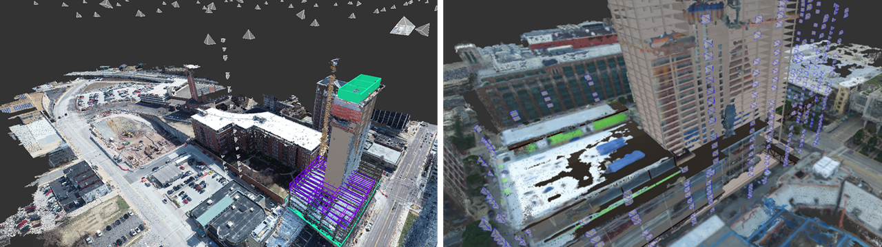
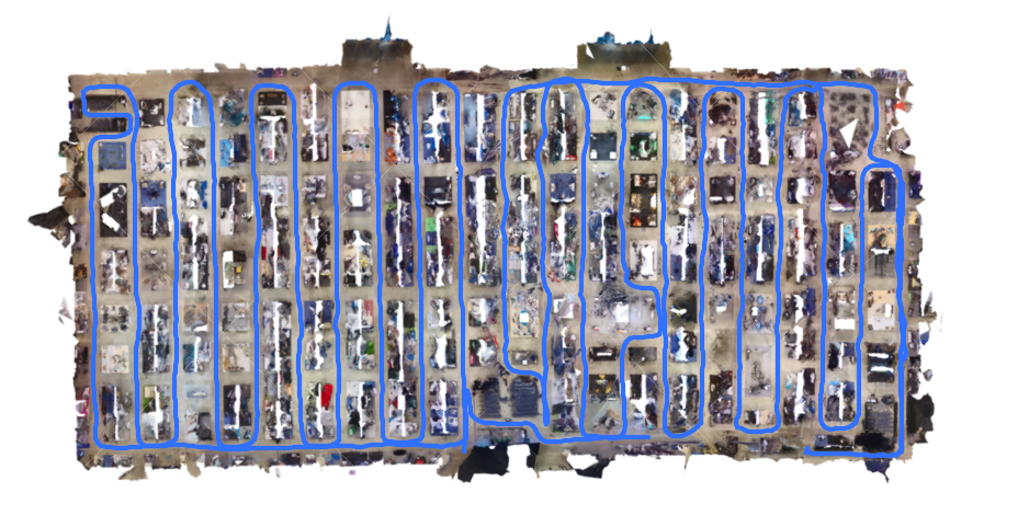
A picture is worth a thousand words, but only if you can find it. That's why organizing images around locations and over time is an important part of our workflow for construction progress monitoring and quality control. To get precise locations of the photos, Reconstruct's computer vision system automatically matches them to past and current images, creating a 4D (3D + time) visual record of the project site. But the matching takes time, and not all photos can be localized.
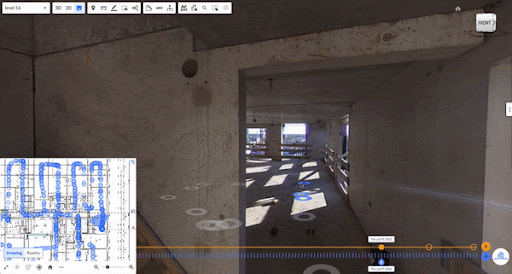
Now, we've added a dash of instant gratification and made a good thing better. When photos are uploaded, Reconstruct's system uses the camera metadata to automatically and immediately place the photos in context of existing models, so that they can be easily found and viewed. Imagine a superintendent wants to review just-completed work on a building facade. As soon as the photos can be taken and uploaded, he can review them in the context of BIM and existing photos, approve payment, and plan for subsequent tasks.
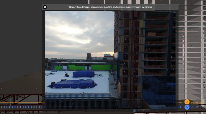
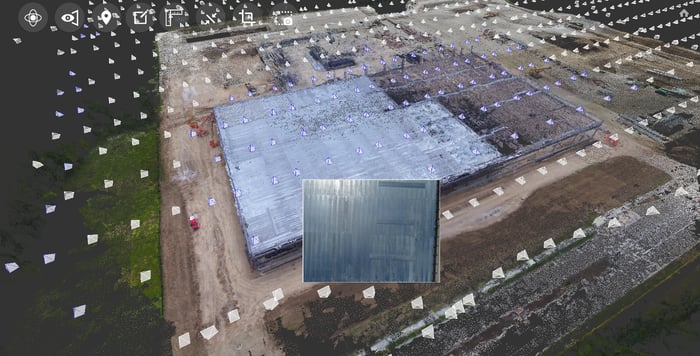
Once processed, our system updates the localization and corrects the distortion for matched images. Any unmatched images remain easy to find and view. This is great for the inspector who takes a few hundred photos to create an overall model for a bridge but also wants close-ups of joints, rust spots, and other target areas. Now, those close-ups are easy to find even if they can't be localized based on matches. No image capture effort is wasted.

There are a few caveats. The localization based on camera meta-data is not as precise as our matching-based localization, so it can't be used as a basis for overlaying BIM or performing 3D measurements. Second, for some cameras, the altitude readings are terribly inaccurate - we have worked out some ways to address this but there is still more to do. Finally, we currently use this feature only for DJI cameras including drones and the hand-held Osmo, though any camera (including smartphones and 360) can still be localized through image matching.
We are excited to offer one more way to make reality capture even more powerful for construction and inspection workflows.
Getting Started with Reconstruct
Want to learn how Reconstruct can help your project? Visit www.reconstructinc.com to start your free trial or request a consultation with one of our team members.
Related Posts
Generate Cleaner 360 Site Captures with Reconstruct’s Image Enhancer
Generate Cleaner 360 Site Captures with Reconstruct’s Image Enhancer
Reconstruct Customers Share 2023’s Top Construction Challenges
From laser scanning inefficiencies to reality capture path confusion, here’s how Reconstruct’s reality mapping software solved top construction challenges.
Q3 Feature Recap - Continuous Improvement
Reconstructs continuous improvement released during Q3, 2022: Image navigation improvement, Reliable file uploader, In-app guides, & resource center.