
.png)
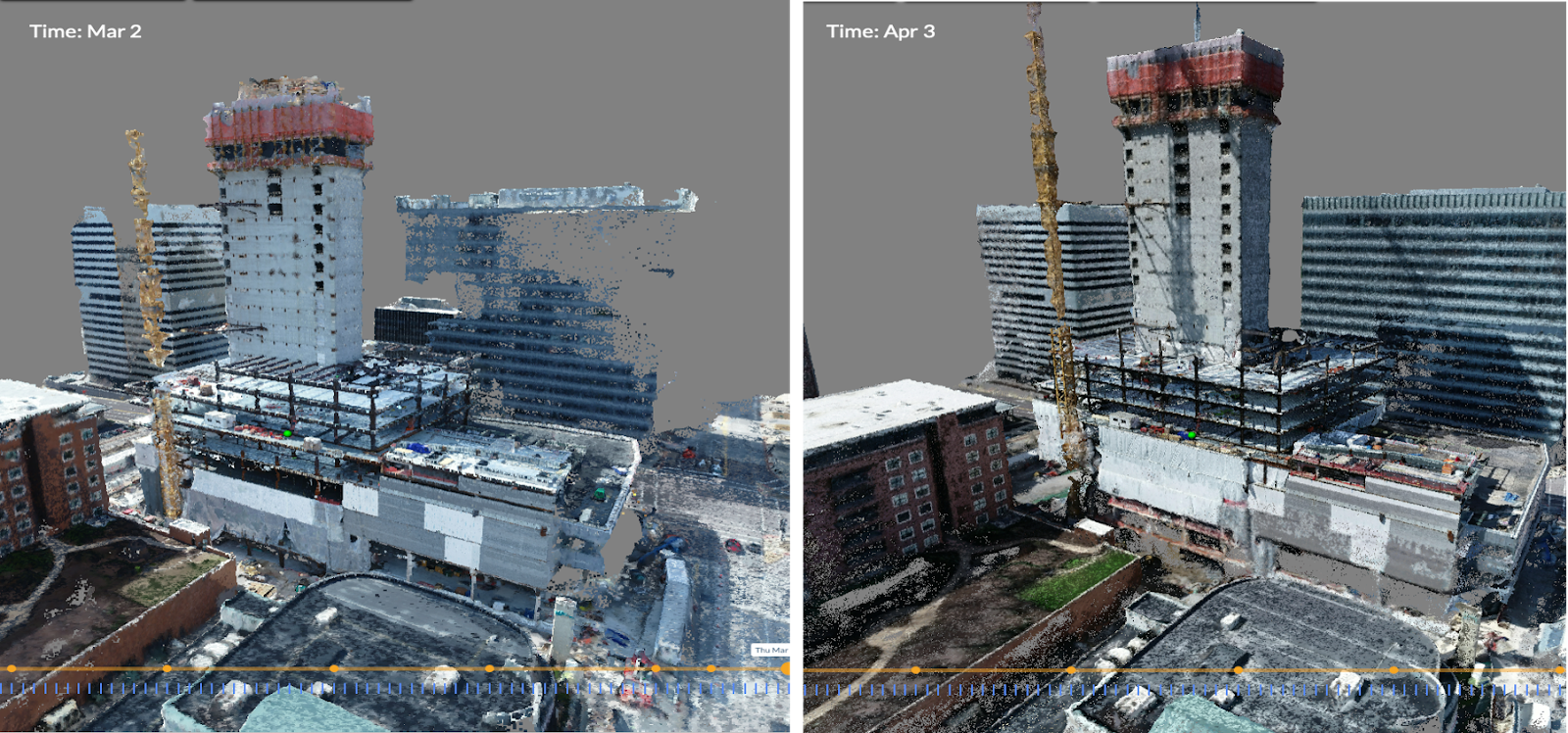
Laser scanning of job sites is prevalent because it produces incredibly detailed 3D point clouds of existing structures and construction projects. However, the resulting data files are significantly large and represent several challenges to get the most value out of your scan data:
- Sharing these very large files, even among lidar experts, is burdensome.
- Opening and navigating scan files, particularly in a point cloud format, is difficult for project stakeholders who don’t work with them as part of their day-to-day job.
- There are no easy-to-use collaboration tools for point cloud data.
Scan models are generally viewed independently, with no basis for comparison or integration to other forms of reality capture, BIM, 2D design, or other models on a project timeline.
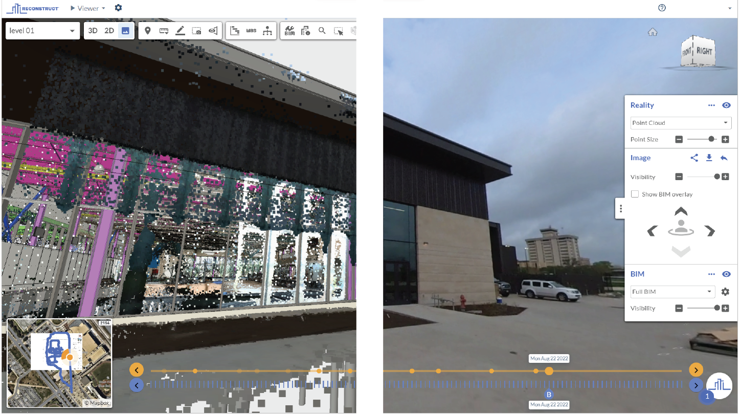
Reconstruct’s Visual Commander Center ends these challenges by placing all forms of reality capture (laser scan, structured light, 360 camera, drone, cell phone videos/images, etc) into one easily shareable viewer and orienting all reality capture, with a consolidated coordinate system, on one project timeline.

Feature & Benefits Overview
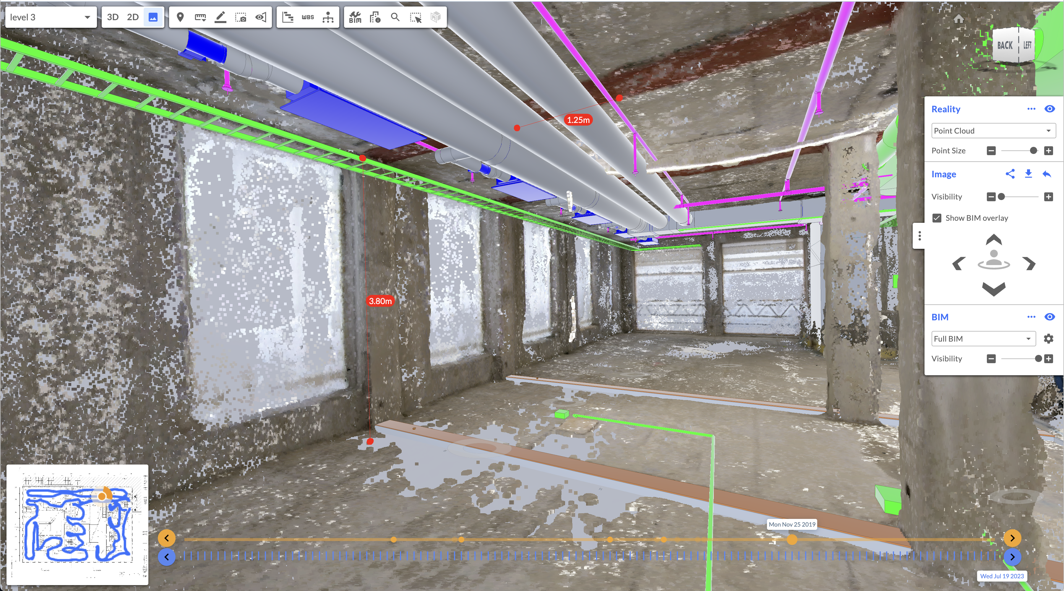
Reconstruct now supports the upload of E57 files, bringing scan data into the project timeline alongside all other forms of reality capture.
Reconstruct enables full import of both structured and unstructured E57 file formats. What is the E57 file format? It's a compact vendor-neutral format for storing point clouds, images, and other data produced by 3D image systems such as laser scanners (Faro Leica, NavVis, Trimble RealWorks, Z+F, and many others) and other infra-red based devices such as Matterport and iPhone/iPad Lidar.
How do you benefit from this?
E57 import allows Reconstruct customers to store, share, view, annotate, measure, or distribute their laser scanning point clouds and 2D/3D designs with other stakeholders using the Reconstruct web-based viewer and leverage the same walkthrough experience across all. Here are the key benefits:
- Put all reality capture in one place: photos, videos, 360 walk-thru's, and scan point clouds all on one project
- Mark up, measure, and share laser scan data in a way that makes sense and is navigable by all stakeholders.
- Make scan data more useful: align as-built and as-designed to understand the real progress and quality of your build.
Check out this feature video to see the benefits in action.
Reconstruct's mission is to make the built world a better place to live, work, and play. Together with the improved Visual Command Center, we can make the construction process more enjoyable for all involved.
Ready to take the next step? Please fill out our contact form for a presentation with our field operations specialist.
Related Posts
Photogrammetry for Construction 101
Photogrammetry turns images or videos of an active construction site or completed structure into a 3D representation, also known as a digital twin.
Measurability and Construction Reality Mapping
Reality mapping now allows construction stakeholders to measure digital twins generated from 360 capture, no laser scanning or BIM required.
Why engineers are using reality mapping to “capture” site inspections
Site inspections, which are mandated by law, can be digitally archived via reality mapping technology for improved visibility and legal protection.