Geo-Referenced Reality Capture for Construction Stakeholders
When it comes to capturing the reality of a job site, many photogrammetry solutions offer what's known as georeferencing. Georeferencing refers to providing the GPS coordinates of a given point.
Most reality mapping providers offer two types of georeferencing: flying a drone with GPS technology that takes pictures with GPS information or hiring a survey crew of trained engineers that use lasers and other technology to pinpoint the geographic location of specific coordinates. The former, as noted, requires a drone, and the latter is often prohibitively expensive, especially for frequent remote progress monitoring efforts.
This is one reason Reconstruct has developed its own georeferenced reality capture technology. Unlike other reality mapping solutions for construction, inspection, and engineering stakeholders, Reconstruct offers a third way to pinpoint the geographic location of reality data.
While our technology will gladly accept and blend georeference data captured in the two methods above, we also allow users to connect their own reality capture footage to satellite images of their job site. Simply input the GPS coordinates of your project, and when you open Reconstruct for the first time, it will show you a precise satellite map of your project location.
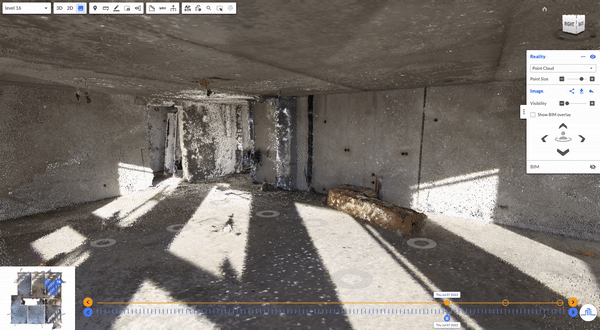
Then, if you upload project drawings to Reconstruct, you can align those drawings to that map. All of a sudden, your design drawings are geolocated, too. No other platform geolocates drawings. And now, when you upload BIM to Reconstruct, you can perform map calibration, which means you are also geolocating the BIM. Finally, when you perform your reality captures, those will be aligned with the geolocated assets to geo-reference your capture automatically, too.
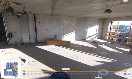
As noted, if you use a drone for capture, those images will be geolocated regardless of what reality mapping software you utilize. However, many stakeholders want to use 360 cameras for frequent construction progress monitoring. After all, they're easy to use, inexpensive, and lightning-fast. The same goes for smartphones: everyone has one, and they capture high-resolution footage of complex installations.
Using Reconstruct’s capture app, you can geolocate 360 and smartphone footage because the capture app allows you to select your starting and ending points. When your capture is complete, Reconstruct’s photogrammetry software will automatically align reality capture to uploaded drawings, which—as noted—have already been aligned with a satellite map. As a result, the reality data now becomes geolocated, too.
The benefit of this is clear: Regardless of what type of reality capture device you use to record construction data, Reconstruct can pin that footage exactly where it belongs on a map. Moreover, Reconstruct will automatically sort and sync all footage by date and time. The result is a single source of project truth that offers you a timestamped, immersive, and as-built walkthrough of your job site in both 3D (maps) and 2D (floor plans) that’s yours to rewind, compare, measure, and inspect for years to come.
About Reconstruct
Reconstruct has set the gold standard for geo-referenced reality capture and digital twinning across the construction, inspection, and engineering industries. Blend footage from any device—including smartphones, 360 cameras, drones, and laser scanners—to create an immersive, measurable, and geo-referenced digital twin of your job site that’ll slash travel time, keep coordination meetings focused, and align all stakeholders with a single source of project truth.
To see your job site in Reconstruct, schedule a personalized demo today.

.png)
.png)