
.png)
If your organization currently uses multiple platforms to process, view, and store geo-referenced reality capture data, there’s an easier way to manage and visualize your job site footage. The right reality mapping software allows superintendents, project managers, VDC managers and other key stakeholders to blend all reality data—including that captured via 360 camera and drone—into one integrated system.
Unlike many other photogrammetry engines, Reconstruct does not require users to utilize its Reconstruct Capture App at the time of capture. Regardless of when job site footage was captured and how it was captured, stakeholders can simply drag and drop reality data in the form of raw images and videos (both flat and 360) into Reconstruct. The reality mapping engine will automatically generate a timestamped digital twin of your job site and allows you to download deliverables such as 3D point clouds, 3D mesh models, and geo-registered orthophotos and floor plans. This immersive, measurable “walkthrough” is yours to share with both on-site and remote stakeholders, either via Reconstruct or Project Snapshot.
That means that even if you’ve been using a competing system to capture job site photos and videos, it’s never too late to get more out of that data. In minutes, your organization can unlock both measurable 2D reality-based floor plans and 3D models of your construction project, both as it appeared in the past and how it appears today.
These digital twins for construction can then be used to perform countless construction, engineering, and inspection-related tasks, including visual progress monitoring, visual production management, visual quality assurance and quality control, facility condition assessments, physical asset inspections, site surveys, construction risk management, and 4D planning and 4D scheduling.
Related: Turn Existing 360 Camera Videos Into a Measurable Walkthrough of Your Job Site
Reconstruct processes all forms of drone, 360, smartphone images and videos into 3D point clouds, mesh models, and floor plans and integrates them against laser scan and Matterport data, if such data has been captured. The resulting “time machine” of reality mapping data can be twinned with 2D and 3D design, offering one integrated street-view walkthrough experience so project stakeholders can review “what is there” vs. “what should be there” for all of their physical assets…whether under construction, under operation, or even when being decommissioned.
.png)
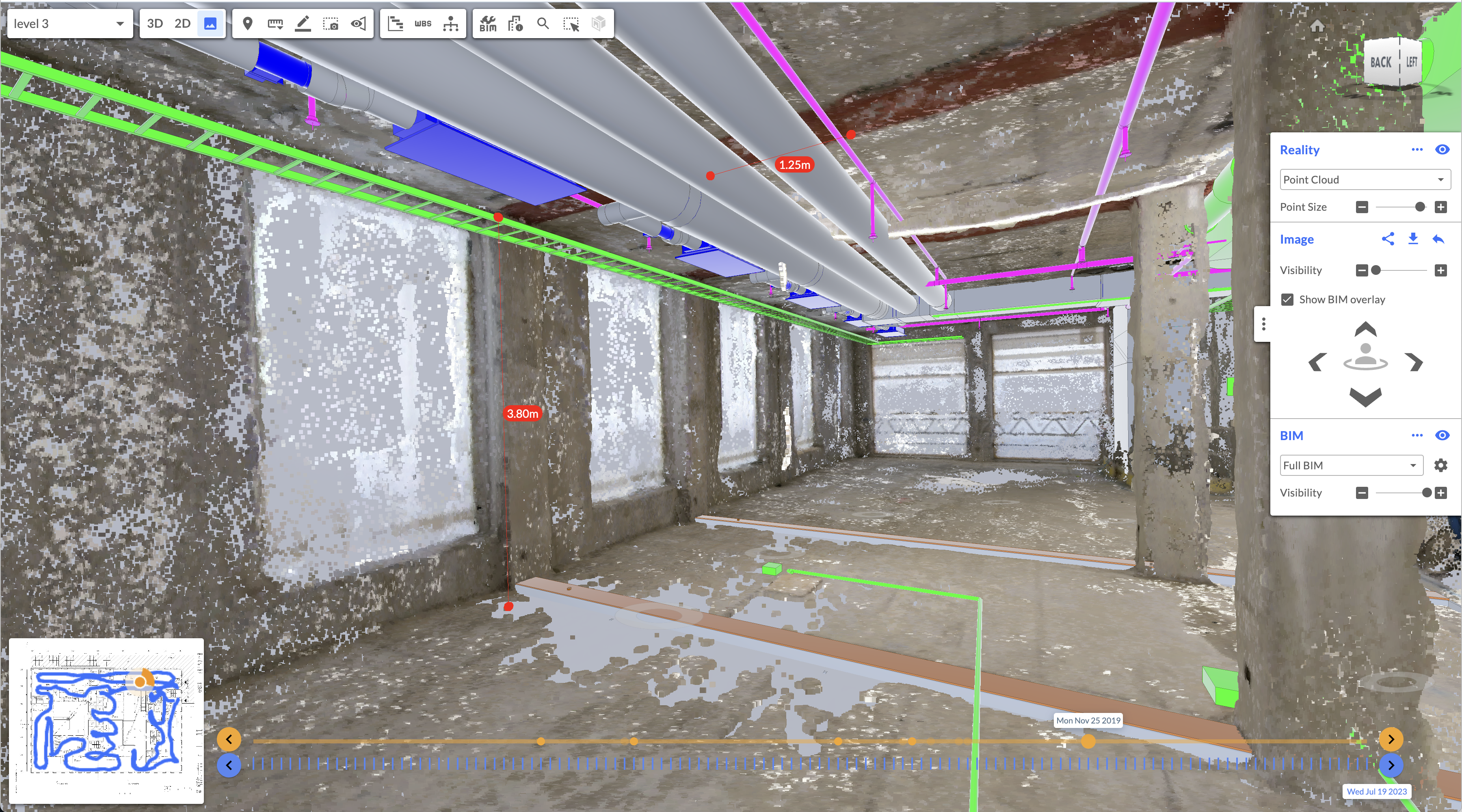
Left to right: 3D point cloud; 3D point cloud + BIM overlay; and 2D reality floor plan + 2D design site plan + map, all within the same Reconstruct web-based viewer.
.png)
Left: Skydio drone images processed with Reconstruct reality mapping engine into 3D point cloud and reality-based 2D floor plan, integrated against 2D and 3D design; Right: FARO laser scan data imported as e57 files, transformed into a street-view walkthrough.
The value of one integrated system for indoor and outdoor reality capture
It's no secret that managing reality capture footage from a variety of devices on several different platforms is a lot of work. While it's true that the hardware and software that captures and processes reality data has only gotten better, many construction, inspection, and engineering stakeholders continue to utilize different systems for every form of capture.
(Not sure what tool is best for a given task? Here’s how to pick the right hardware for every reality mapping use case.)
The result is disparate, sometimes competing sources of project truth that are difficult to piece together and understand…especially if critical stakeholders are not present on the job site. Reconstruct’s reality mapping engine is designed to blend all footage from all devices, regardless of how it was captured or when. That means field teams that use 360 cameras for indoor capture and drones for outdoor capture no longer need to view footage on different platforms.
Moreover, many reality mapping platforms only pin footage to a floor plan. Reconstruct automatically generates reality-based 2D floor plans and 3D reality models of the job site, combining all footage from every device into one timestamped source of project truth. You can even upload your laser scan or Matterport data and blend them with the reality mapping data, all within the same platform.
Instead of relying on point solutions, stakeholders can turn to a single, measurable digital twin for virtually every use case, including streamlining coordination meetings, condition assessments, and remote project monitoring. At once, all stakeholders unlock complete project visibility for all reality data, regardless of the capture device. This “simplicity” not only creates more efficient processes for technology stakeholders but improves adoption for other key team members while increasing cost savings and reducing project risk.
Additional benefits include reducing the cost of rework, accelerating project timelines, slashing travel to the job site, improving communication between teams, and allowing organizations to perform their own 3D scans and site surveys for progress monitoring needs.
These benefits improve project outcomes for owners, owners’ representatives, contractors, and the professionals who support them. By allowing stakeholders to compare what's there versus what should be there, digital twins improve outcomes in the built world.
Why transform raw data into a digital twin?
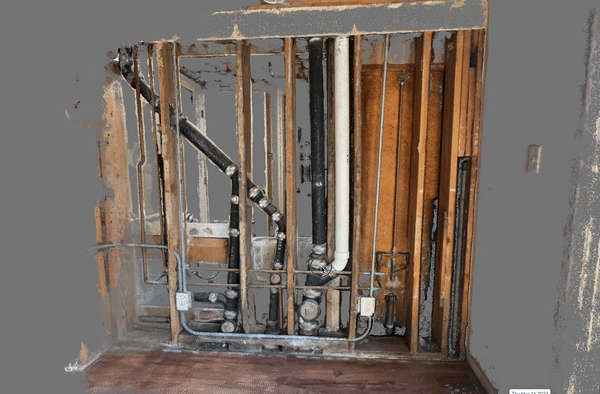
There are various reasons why stakeholders may create an online as-built of construction projects after the fact. Online as-builts can enable better remote access inspections and periodic condition assessments. They can also be used for asset management and preventive maintenance tasks. They are also ideal when building owners face challenges from tenants or other liability claims. That’s because, with the help of Reconstruct’s photogrammetry engine, stakeholders can turn back time to identify what’s behind a wall or how a particular installation was sequenced without the disruption, cost, or delay of demolition.
Digital twins can also allow remote stakeholders to begin performing frequent project monitoring and QA/QC tasks without stepping foot on the job site. This is especially true when the digital twin comprises data capture via various tools, including 360 cameras and drones. Together, this technology can capture every inch of a job site, even in the hardest-to-reach areas.
About Reconstruct
Reconstruct is a cutting-edge reality mapping solution that blends all footage from all devices, including 360 camera and drone. To see your project in Reconstruct, schedule a personalized demo today.
Related Posts
.gif)
360 Progress Capture: Creating a Digital Twin for Remote Construction Monitoring
360 progress capture enables field teams to quickly and reliably capture immersive job site images throughout the construction process.
Smartphones for 3D Reality Mapping in Construction
Smartphones are an easy, reliable way to capture construction details for 3D reality mapping and site surveys.
Measurability and Construction Reality Mapping
Reality mapping now allows construction stakeholders to measure digital twins generated from 360 capture, no laser scanning or BIM required.