
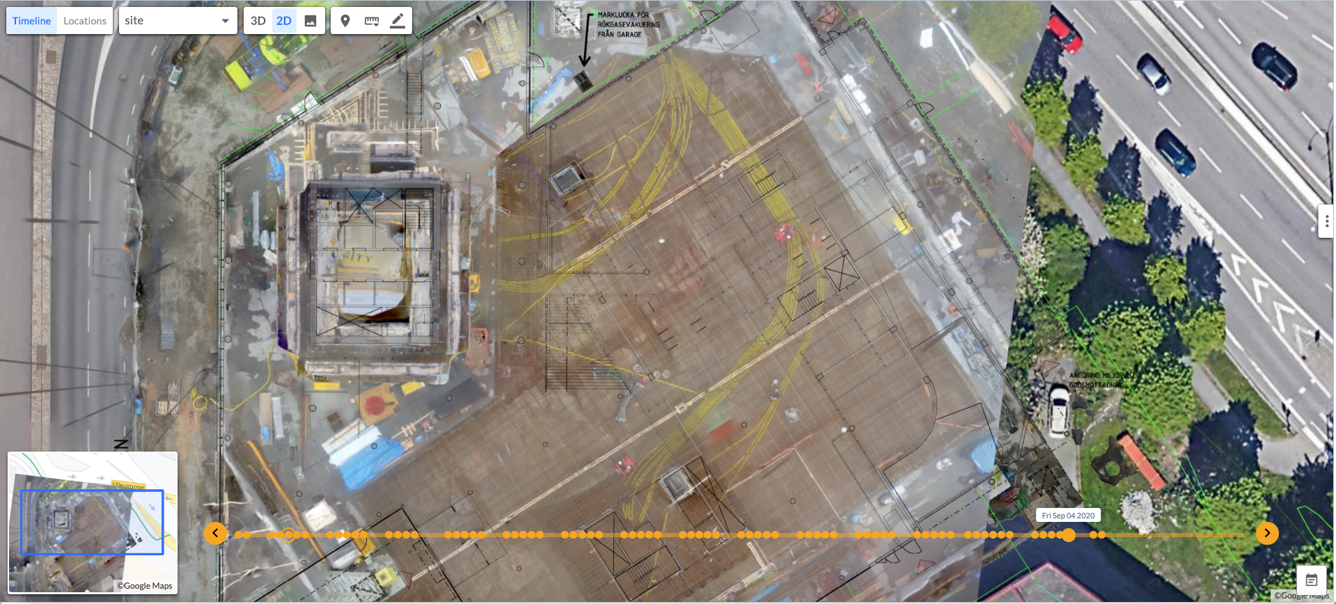
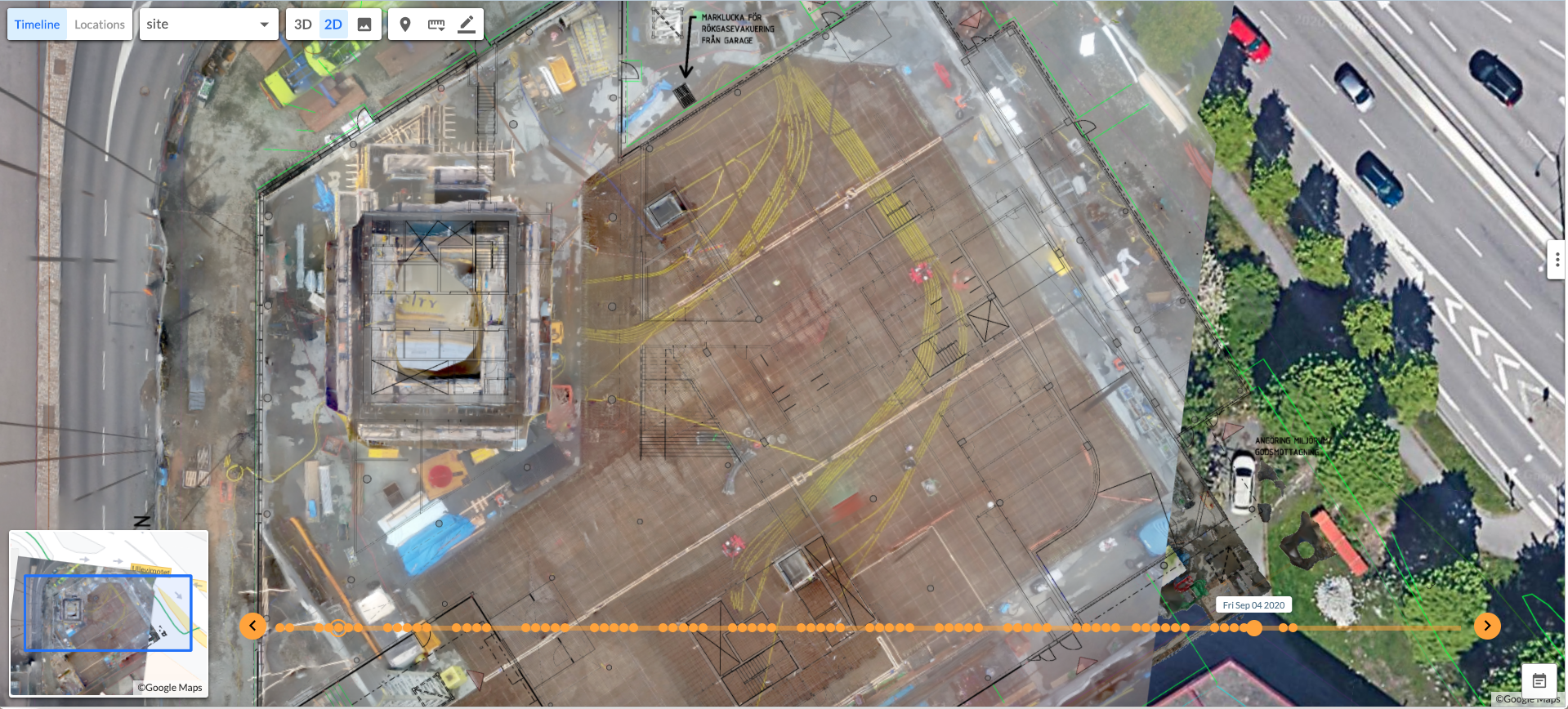
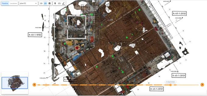
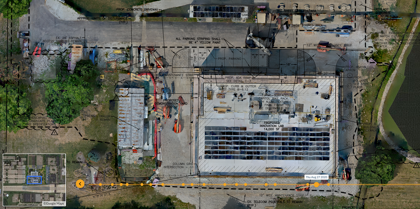
Nothing provides context and spatial awareness like a map. In daily life, we use street maps and satellite maps to figure out where we are going and what it will look like. In construction, drawings are maps that show where work should happen. For earthmoving and foundations, maps produced by surveyors or drones are commonly used for validating cut-and-fill, placement, and progress.
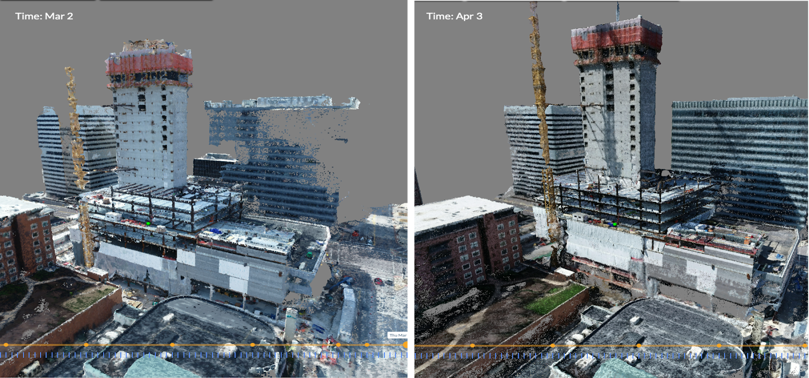
Reconstruct® now takes maps to another level. We can create existing conditions maps of floors, walls, ceilings, chimneys, cooling towers — you name it. These maps can be used indoors and outdoors for navigation, inspection, quality control, and progress monitoring.
Ease of capture
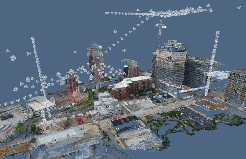
Reconstruct® is the only service that provides indoor floor maps from 360 video. You don’t need an expensive camera, laser scanner, tripod, or any expertise. Simply walk through the site with a consumer 360 camera, upload the video, get back a 360 photo tour, 3D models, and maps of the site. The technology behind these maps is quite sophisticated, but the experience is simple: capture, upload, map. We can also generate maps from crane cameras, drones, and other cameras, indoors or outdoors.
 Floor map from 360 video
Maps with insights
Reconstruct® can provide color floor plans or “as-built drawings” that are directly comparable to as-designed drawings, based on automatic analysis of the photographs. With time, capabilities will grow to provide more automated analysis of progress and quality.
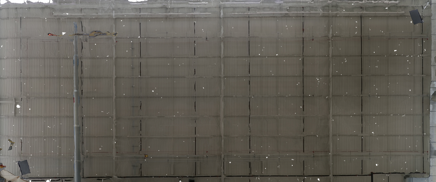
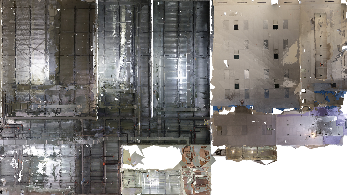
Maps of every surface
When you imagine a map, you probably imagine a top-down view of a road or site layout. Now, imagine maps of the ceiling that show the layout of pipes, duct, and electrical. Or a map of the surface of a chimney that can be used directly for inspection and reporting location of defects. Only Reconstruct® provides these mapping capabilities through our Surface Mapping Tool.

What you can do with Reconstruct® maps
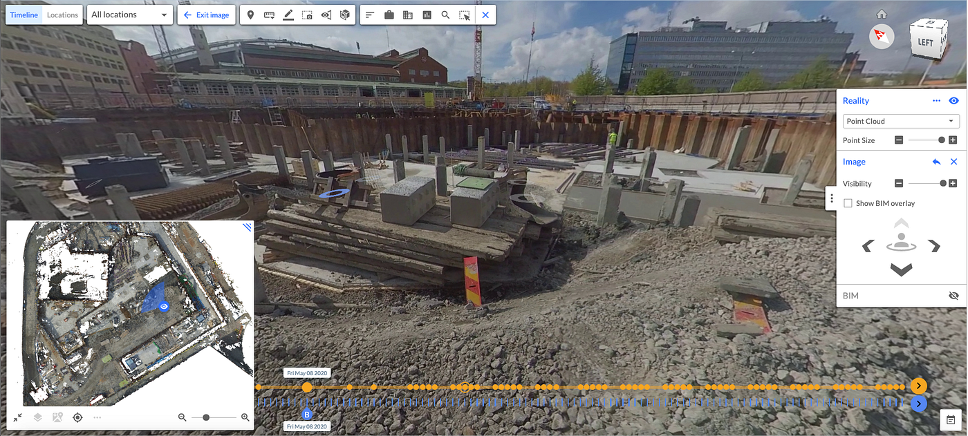
- Navigation: users of our 2D/3D viewer can view images and point clouds while using the map to show position and orientation within the site context
- Inspection: visually and remotely verify work in place; identify defects in material or construction; measure areas and distances
- Quality control: see “what is there” vs. “what should be there”; overlay on drawings to ensure correct placement, as shown below
- Reporting: demonstrate completeness and quality of construction with easy to understand visuals
- Safety: annotate color floor plans and other maps to create awareness of safety hazards or areas for caution
- Coordination: color floor plans of current site conditions make it much easier to plan, avoid clashes, and see and remember who does what where
Related Posts
Photogrammetry for Construction 101
Photogrammetry turns images or videos of an active construction site or completed structure into a 3D representation, also known as a digital twin.
.gif)
Compare design against existing 360 and drone reality capture
Use existing reality capture data from 360 cameras, drones, and other devices to compare design and plans against what’s actually been constructed.
What is photogrammetry software for construction?
Photogrammetry software, in construction, extracts geometric information from 2D reality capture images to create a 3D “digital twin” of the job site.