What is photogrammetry software for construction?
In the construction, inspection, and engineering space, various cutting-edge tools and technologies can help stakeholders visualize and understand their projects and schedules better than ever before. One such technology is photogrammetry.
In this article, we will examine photogrammetry software, its use by construction, inspection, and engineering stakeholders, and how new developments in photogrammetry technology have made the solution more affordable, accessible, and intuitive than ever.
What is photogrammetry in construction?
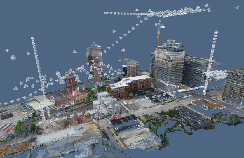
For construction stakeholders, photogrammetry is a popular technique that extracts geometric information from reality capture images. The technology takes multiple overlapping images of a construction site, completed asset, or infrastructure and analyzes the relationship between common points in this footage. Then, the photogrammetry software can “reconstruct” the project in 3D.
Leaning on principles such as geometry, trigonometry, and computer vision, photogrammetry can make 3D representations of footage despite absorbing only two-dimensional images and video.
What types of footage can be analyzed by a photogrammetry engine are determined by the photogrammetry software selected. Reconstruct, for example, can analyze virtually any image and video, including those taken by a smartphone, drone, 360 camera, laser scanner, and more. Additionally, unlike other photogrammetry software providers, Reconstruct can blend all of this footage to create a single source of project truth.
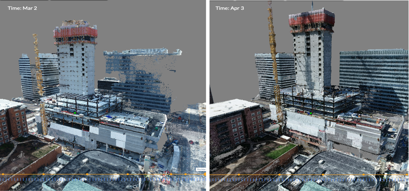
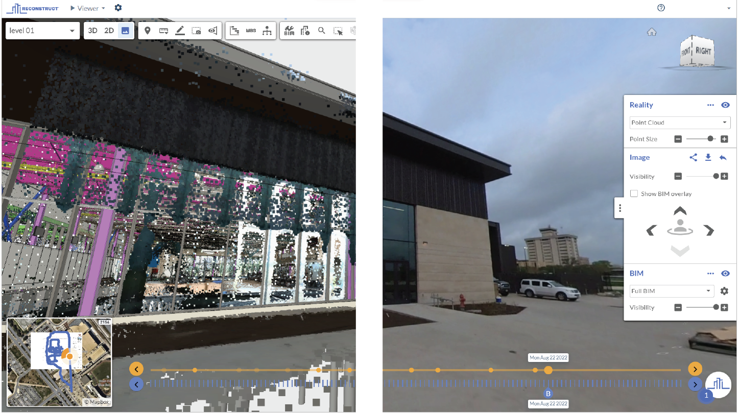
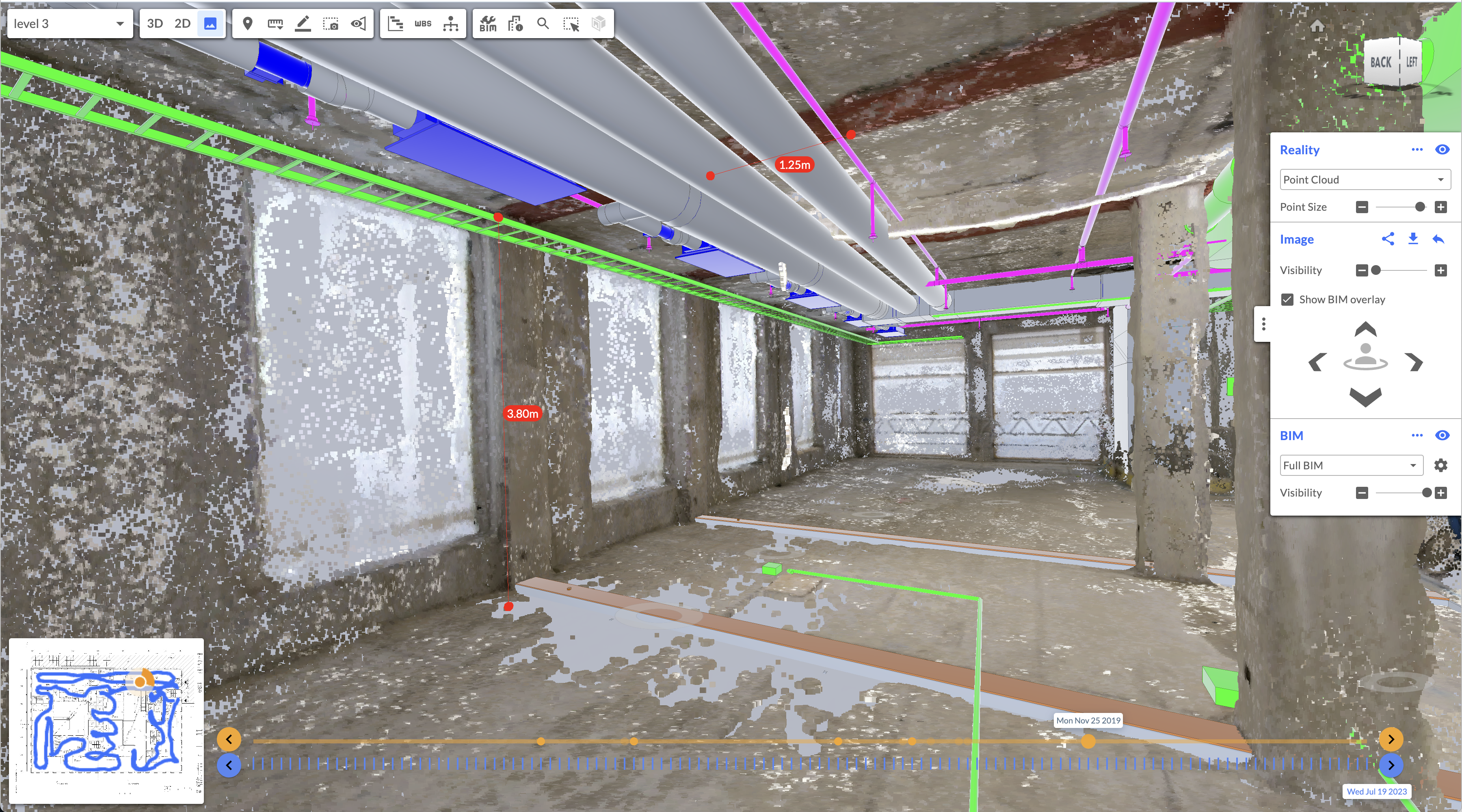
The result of good photogrammetry software is a digital twin for construction that empowers on-site and remote stakeholders with unprecedented visibility of the job site. Moreover, the best photogrammetry engines will either integrate with or provide first-hand key features that unlock even more benefits for stakeholders. Such benefits include the ability to overlay 2D and 3D designs and drawings over reality data, the ability to measure accurately, the ability to integrate BIM and schedule, the ability to annotate issues and concerns on the job site, and the ability to turn back time to review construction at any point along a project’s timeline.
Reality mapping software vs. photogrammetry software
Often, “reality mapping software” is used interchangeably with photogrammetry software. While there are some subtle differences, both refer to an engine’s ability to reconstruct the scene of a job site using footage captured in 2D.
How has photogrammetry software changed over the past few years?
In the past, creating as-built documentation of a job site was typically reserved for the final phase of construction when stakeholders needed to capture the final dimensions of a completed construction project. However, with the advent of accessible and affordable photogrammetry software, more organizations have begun to rely on photogrammetry software for improved remote construction progress monitoring and quality control.
One of the critical reasons for this is that virtually any device can now be used for reality capture, of which the resultant footage a photogrammetry software provider later processes. These devices include affordable and everyday hardware such as smartphones and 360 cameras.
Additionally, these devices are easy to operate and require no additional resources on the job site. Instead, just about any field team member can perform frequent reality capture and effortlessly provide that footage to a photogrammetry software engine. The result is an accurate and measurable digital twin of the construction site that offers stakeholders worldwide an immersive walk-through of the construction project’s current conditions.
This can save organizations significant time and money, especially if they previously relied on experts' frequent travel to the job site. Additionally, photogrammetry software can be used long after construction is completed for current condition assessments, infrastructure assessments, and facility assessments.
While reality mapping will not replace necessary in-person walkthroughs in every instance, photogrammetry software has been proven to increase visibility in construction projects from demolition day until the end of a building's useful life.
Currently, photogrammetry software is the top choice for remote project monitoring. But as computer vision, recognition, neural radiance fields (NeRF), and large language models continue to improve, more and more AI-powered technology will become available to construction stakeholders.
About Reconstruct
Reconstruct has set the gold standard for photogrammetry software for construction, inspection, and engineering stakeholders. Because Reconstruct has been engineered to generate digital twins using virtually any footage—including footage captured years ago—it's never been easier to create a virtual duplication of your job site.
To learn more about our photogrammetry software and to see your own project in Reconstruct, contact us for a personalized demo.