Now more than ever, airport renovation stakeholders are encountering digital twin requirements as early as the request for proposal (RFP) process. In the past, a digital twin might have been considered a nice to have, not a need to have. But today, the landscape has changed, and it has increasingly become a non-negotiable that a digital twin of airport construction be handed off at the end of a project.
In this article, we will zero in on how reality mapping technology has made it easier, faster, more affordable, and less disruptive than ever to create and maintain a digital twin during airport construction and maintenance and beyond.
Key takeaways
- Increasingly, airport construction and renovation projects are now requiring “digital twin” documentation of work performed.
- Reality mapping software enables stakeholders to use various devices–including drones, smartphones, and 360 cameras–for reality capture. Since these forms of reality capture are quick, intuitive, and non-resource intensive, they save stakeholders time and money while increasing project visibility across teams.
- 360 reality capture, which is ideal for frequent progress monitoring, can capture panoramic job site footage at a rate of 1,000 square feet per minute–no tripods or expert surveyors required.
Filling Digital Twin Requirements Quickly Using 360 Capture
One of the chief benefits of utilizing modern reality mapping technology is that most digital twin requirements can be satisfied with surprisingly little extra lift. In fact, it's no longer necessary to carve out significant resources and pause construction or maintenance for expensive and expert-performed laser scanning. Instead, virtually anybody on the team can conduct fast and accurate reality mapping using a device as simple as a 360 camera or a smartphone.
360 capture, for example, can record up to 1000 square feet of panoramic data in a single minute. This enables immersive and detail-rich reality capture that can be conducted by practically anybody on the job site in a matter of minutes, not hours or days. Plus, with a 360 camera, there’s no need to set up a tripod or even triangulate location. This is all done automatically.
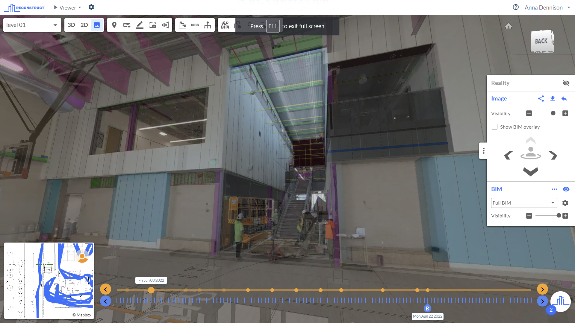
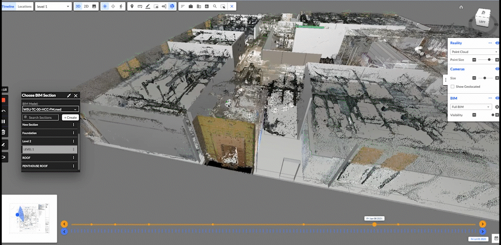
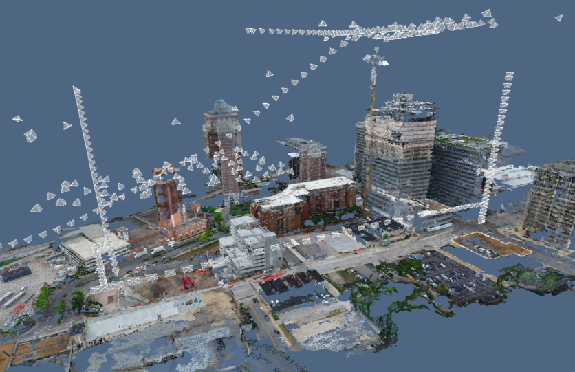
Additionally, if Reconstruct’s photogrammetry software is used, footage from all types of devices can be blended together into one single source of project truth that's already pinned in space and over time. The result is an accurate, measurable digital twin that can be rewinded to visualize the state of the airport at any given date or time.
This allows stakeholders to see through walls or turn back the clock to make critical decisions about the next steps in construction or make more informed choices regarding maintenance and operations.
Moreover, because performing reality capture with software such as Reconstruct is so quick and intuitive, it can be performed much more frequently than laser scanning. At many airports, reality data is captured at least once a week, improving visibility during construction progress monitoring and quality control efforts. As a result, even when construction or renovation is complete, stakeholders walk away with as-built documentation that reflects not only the final state of construction but every other stage of the process, too.
There is no need to devote resources to a project engineer who must record construction or renovation progress for half or a whole day once a week. Right then and there, labor costs can be reduced simply by empowering field team members who are already on-site to capture job-site reality using a smartphone or 360 camera in minutes instead.
About Reconstruct
Reconstruct has set the gold standard for reality capture at airports by empowering stakeholders to create digital twins using reality data from all types of devices, including laser scanners, drones, smartphones, and 360 cameras.
To see how easy it is to satisfy digital twin requirements for your airport construction project, schedule a personalized demo today.