Across every industry, new advances in reality mapping technology have enabled stakeholders, both on-site and remote, to immerse themselves in active job sites. In the airport space, in particular, allowing frequent and rapid reality capture of current conditions has significant benefits, from improving communication to reducing unnecessary travel and expenses to drastically improving efficiencies for all involved stakeholders.
In this article, we will zero in on how 360 capture helps airport stakeholders improve efficiencies throughout the construction process.
Understanding 360 capture during airport construction
Many airports use some form of regular documentation to keep remote stakeholders apprised of construction progress. That said, much of this documentation tends to be either time-consuming, expensive laser scanning--or affordable but limited still photography.
With still photography, documentation shared with offsite stakeholders is not immersive and offers a limited field of view. As a result, stakeholders won't always see what they need to see… and often times, they'll have to ask for a particular picture, view, or update if what they’re curious about doesn’t appear in the pictures they’ve been given.
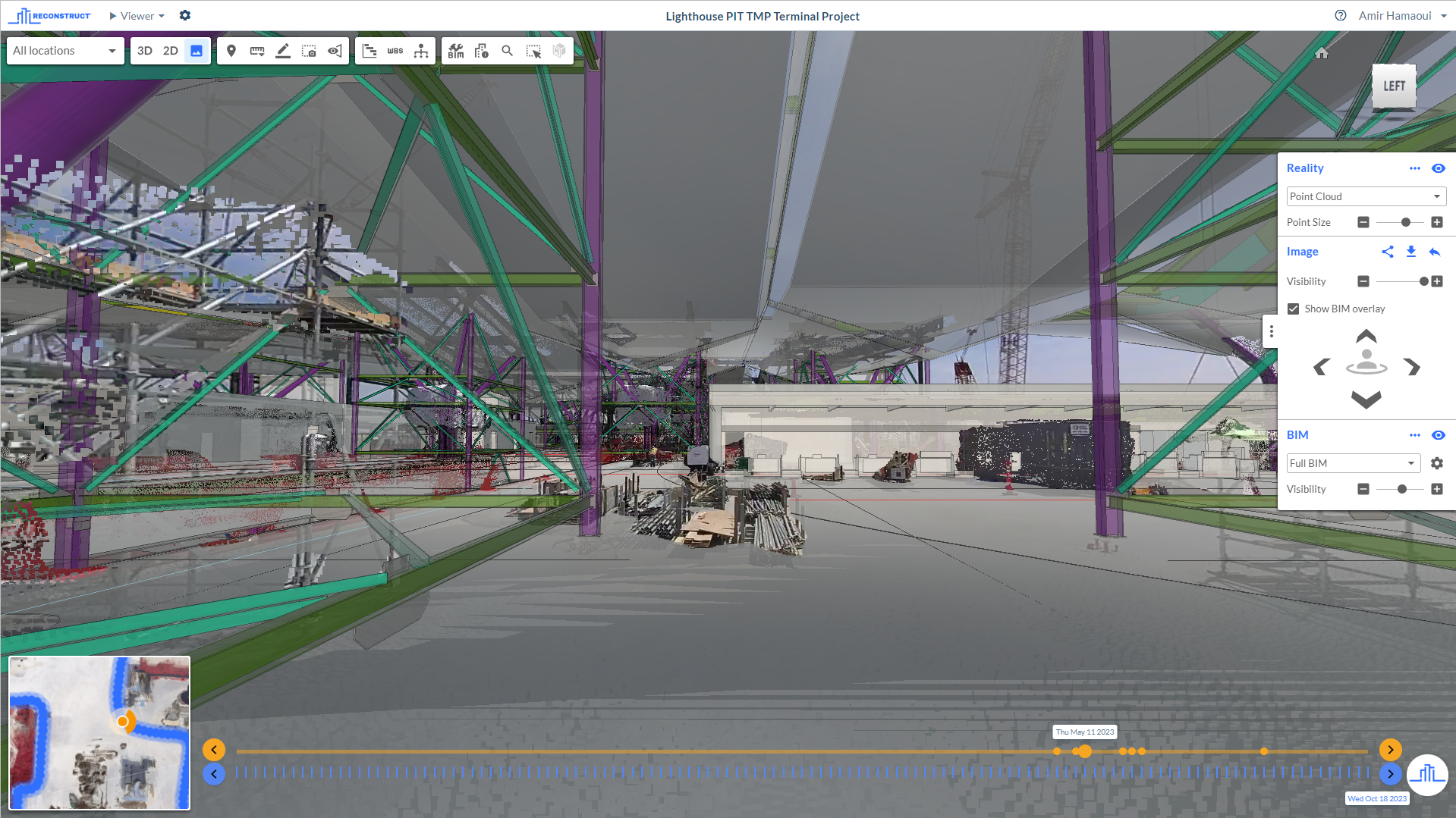
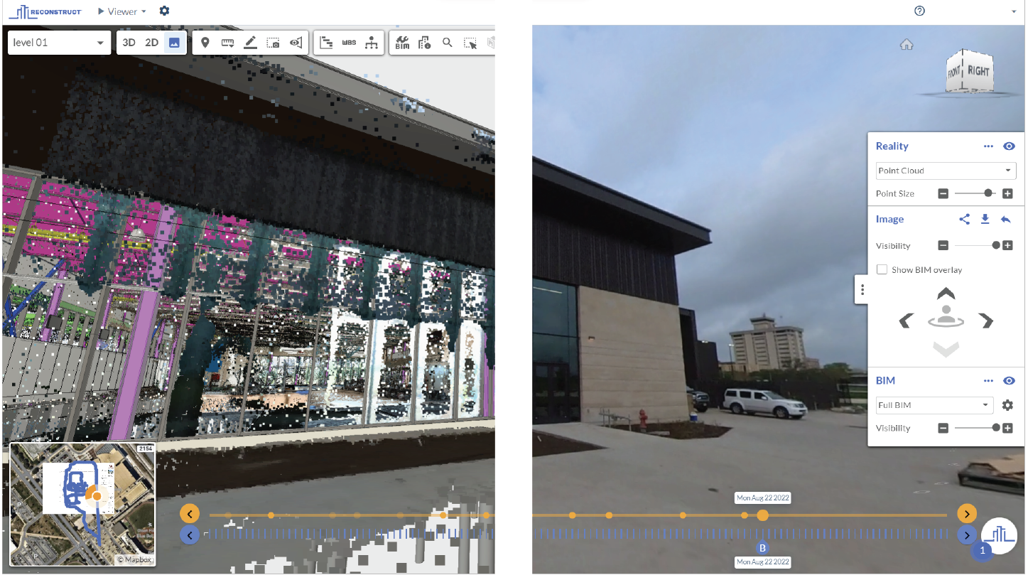
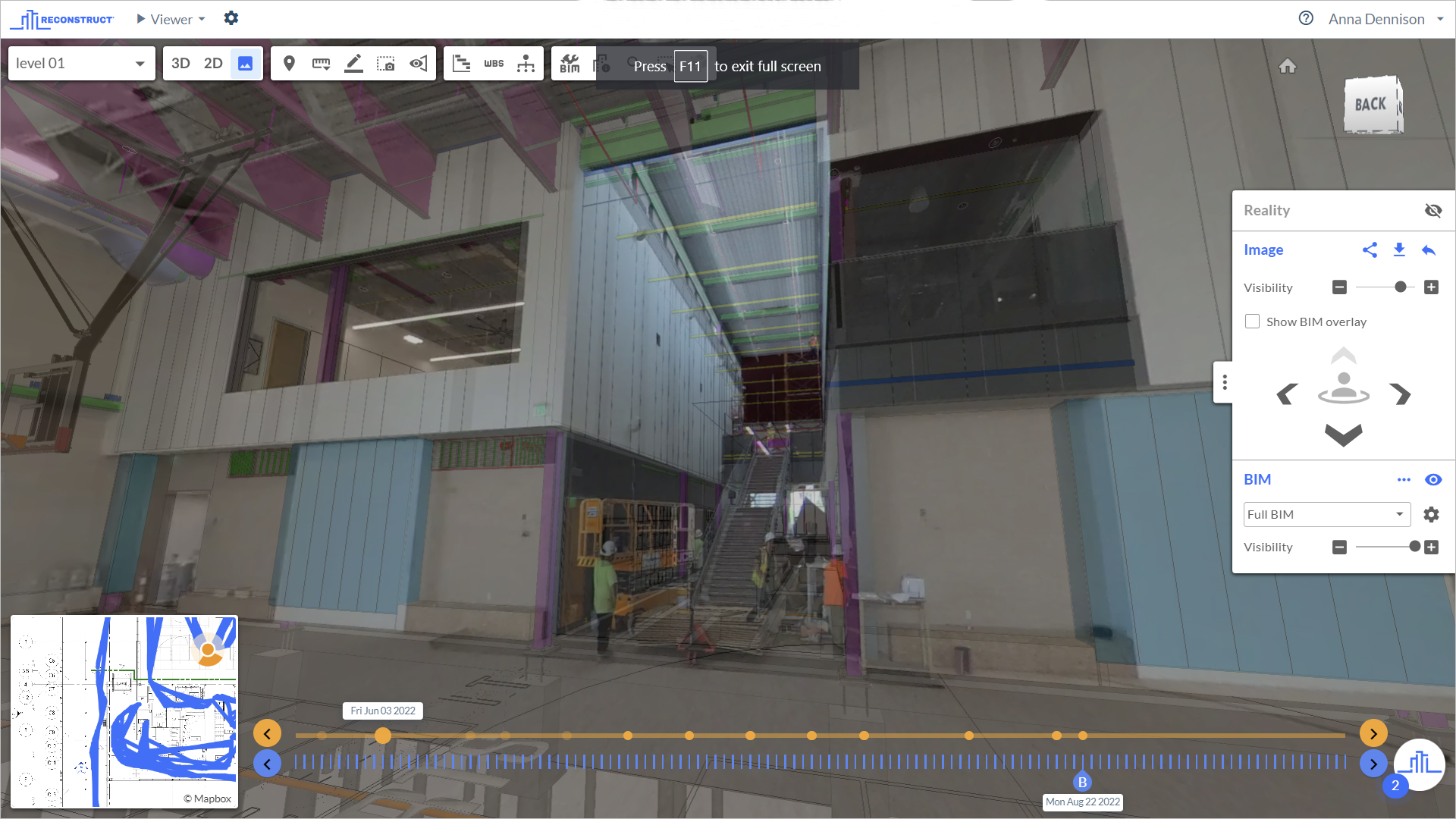
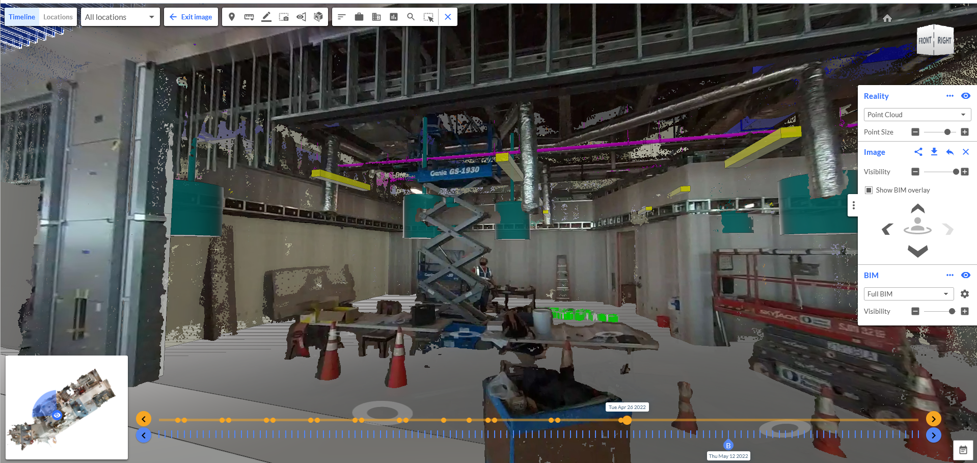
But, with the help of 360 reality capture, panoramic footage of the job site is available. This means that stakeholders will have complete visibility into the current conditions of a job site, even if they never step onto the airport property.
With 360 capture, there’s no “curating” of a job site. Instead, the camera automatically (and panoramically) captures the current conditions of the airport at a rate of up to 1,000 square feet per minute. What's more, this reality capture can be performed by practically anybody on the job site. There is no need to hire an expert, rent special equipment, or even shut down construction or other related tasks so that capture can be performed.
The capture is quick and intuitive. If stakeholders use a photogrammetry engine like Reconstruct, the footage will be automatically pinned in space and over time create an up-to-date, timestamped, completely “rewindable” digital twin of the airport.
This allows for marked improvements in construction and project management efficiencies. Moreover, additional footage from other devices, such as that captured via drone, smartphone, or laser scanner, can be blended into the digital twin at any time.
Related: Smartphones: Blending High-Resolution Reality Capture Data to Your Digital Twin
Using 360 capture alongside laser capture
For airport stakeholders that had previously relied on laser scanning to capture airport conditions, 360 capture and other reality mapping techniques offer an affordable, more efficient, and markedly faster way to record and share construction progress.
Some customers, for example, have reduced laser scanning to once a month and have begun implementing Reconstruct reality capture to stay informed between laser scans without giving up accuracy and visibility. Laser scanning provides stakeholders with the utmost accuracy, while 360 capture fills in the gaps between these captures at a fraction of the cost and time—and with very good accuracy, too.
Additional efficiencies of reality mapping at airports
A frequent reality mapping strategy provides a wide range of efficiencies, from reducing the amount of travel required by remote stakeholders to increasing the overall transparency of current construction conditions to all collaborators.
One additional efficiency that many stakeholders aren't aware of is unlocked by utilizing a cut-and-fill measurement tool. This tool is typically used when an excavator digs out a basement for a structure, and all of that dirt is moved into a stockpile. Reconstruct, in particular, can measure the number of cubic yards in that stockpile.
So, to gather this information, an on-site team member uses 360 capture to document the stockpile. Then, a remote stakeholder, such as an owner or an owner's representative, can use Reconstruct technology to calculate how many cubic yards have been removed from the job site. This can ensure all parties that the amount paid matches the work done—and this verification process can be completed quickly, too.
This cut-and-fill measurement feature is often used on airport projects, either because stakeholders are excavating for a new terminal or making space for a new runway.
One final benefit of reality mapping for airports is its ability to bring all stakeholders—including remote ones—into a single construction trailer…figuratively, of course. This matters because airport construction is a highly collaborative process that usually relies upon a whole team of trades throughout the construction, inspection, and engineering processes. By implementing an affordable, intuitive, and repeatable reality mapping strategy, these projects can maintain a digital twin of airport construction conditions week after week and then share the resultant 3D maps and 2D floor plans with all stakeholders, anywhere across the world.
Reconstruct has no limit on how many registered users can use or view the software, enabling stakeholders to collaborate on an asset without cutting corners or keeping certain stakeholders in the dark.
About Reconstruct
Reconstruct has set the gold standard for reality mapping during airport construction and renovation. With Reconstruct, stakeholders can rapidly create highly accurate, measurable, and immersive digital twins of runways, terminals, and other airport structures and infrastructure. They can then use these assets for a variety of use cases, including quality control, assessments and inspections, verification of payment applications, liability protections, and more.
To learn more about reality mapping for your airport construction project or to see your project in Reconstruct, schedule a personalized demo today.