How Reality Capture & Mapping Forms a Digital Twin for Construction
In the construction, inspection, and engineering space, more and more stakeholders are using cutting-edge reality mapping technology to create a digital twin of a construction site, a completed structure, or infrastructure. The benefits of creating a digital twin are vast, ranging from improving job site transparency for all stakeholders to enabling remote construction progress monitoring, boosting construction quality control efforts, and allowing stakeholders to walk away from completed construction with as-built documentation of their project.
In this article, we will walk through the basics of how performing reality capture on a job site or finished structure or infrastructure leads to the formation of a digital twin.
Digital twins for construction begin with on-site reality capture
The creation of a digital twin begins with the capture of job site reality data, which can be gathered in various ways. Traditionally, such footage was captured via a LiDAR scanner, an expensive but highly accurate device that slowly but surely captures reality data. Due to the expense and slow pace of laser scanning and the fact that it must be performed by a professional, this practice is now reserved almost entirely for as-built documentation performed at the end of a construction project.
Today, thanks to the evolution of reality mapping and photogrammetry technology, rapid and accurate reality capture can be performed using everyday devices and the staff you already have on the job site without disrupting the flow of construction. The most popular devices for such reality capture are 360 cameras, smartphones, and drones.
The 360 camera enables immersive and panoramic 360 capture. These devices are inexpensive and easy to operate. A single operator can walk a job site or completed structure or infrastructure while the camera grabs footage from all around them. Capturing 1,000 square feet takes only about a minute.
When more in-depth and higher-resolution imagery is required, a smartphone perfectly complements the 360 camera. Contractors, tradespeople, or anyone else on the job site can simply snap a picture with a smartphone and record more complicated installations such as plumbing, HVAC, or electrical.
Drones are particularly helpful for exterior shots and for capturing hard-to-reach or unsafe areas. Unlike 360 cameras and smartphones, there are restrictions and regulations about who can operate a drone. That said, inexpensive and easier-to-fly models do exist, and those are being used on job sites more and more.
While every job site and use case is unique, most projects in need of frequent progress monitoring will perform what are called reality capture walks once a week. Since the goal here is job site monitoring and quality control, the need for absolutely perfect accuracy is reduced, making 360 capture the ideal solution. As mentioned, additional footage via drone and smartphone can also be added when necessary.
Transforming reality capture into a digital twin for construction
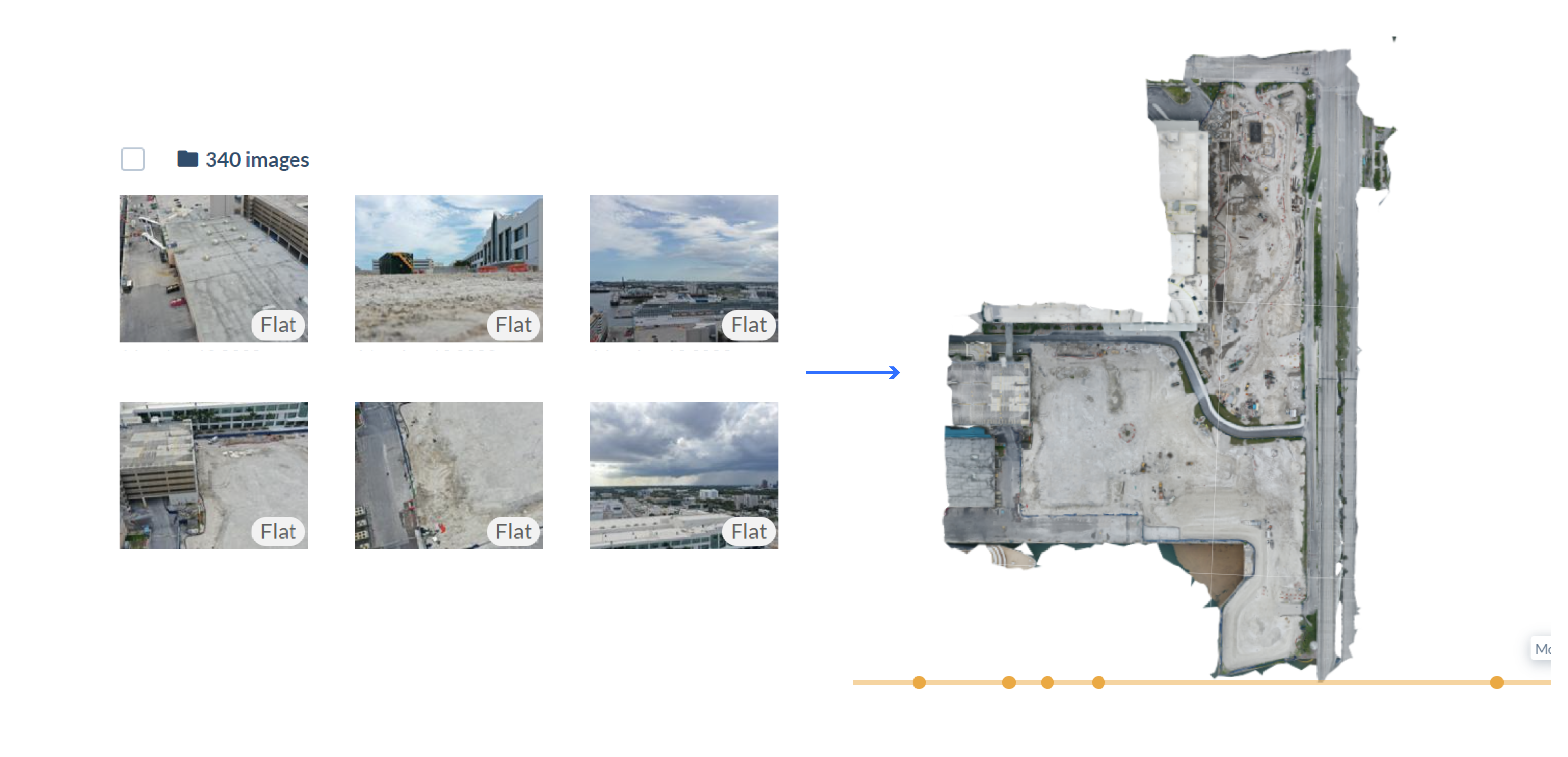
If you use Reconstruct, this low-cost and high-speed method of reality capture can be fed to Reconstruct’s photogrammetry engine. The engine automatically pins the data in space and over time to create a digital twin of your job site. If you've uploaded a satellite map before, then your reality capture will be automatically georeferenced.
Reconstruct’s proprietary photogrammetry engine uses state-of-the-art computer vision and AI algorithms to process 360-degree video capture of your project. It determines the location of each video frame in 3D, creates a sparse 3D reconstruction of the scene, and then uses the pixels in each video frame to fill in more points, creating a dense reconstruction of the project (a point cloud). Finally, it uses this generated point cloud to create a 2D colored floor plan of your project.
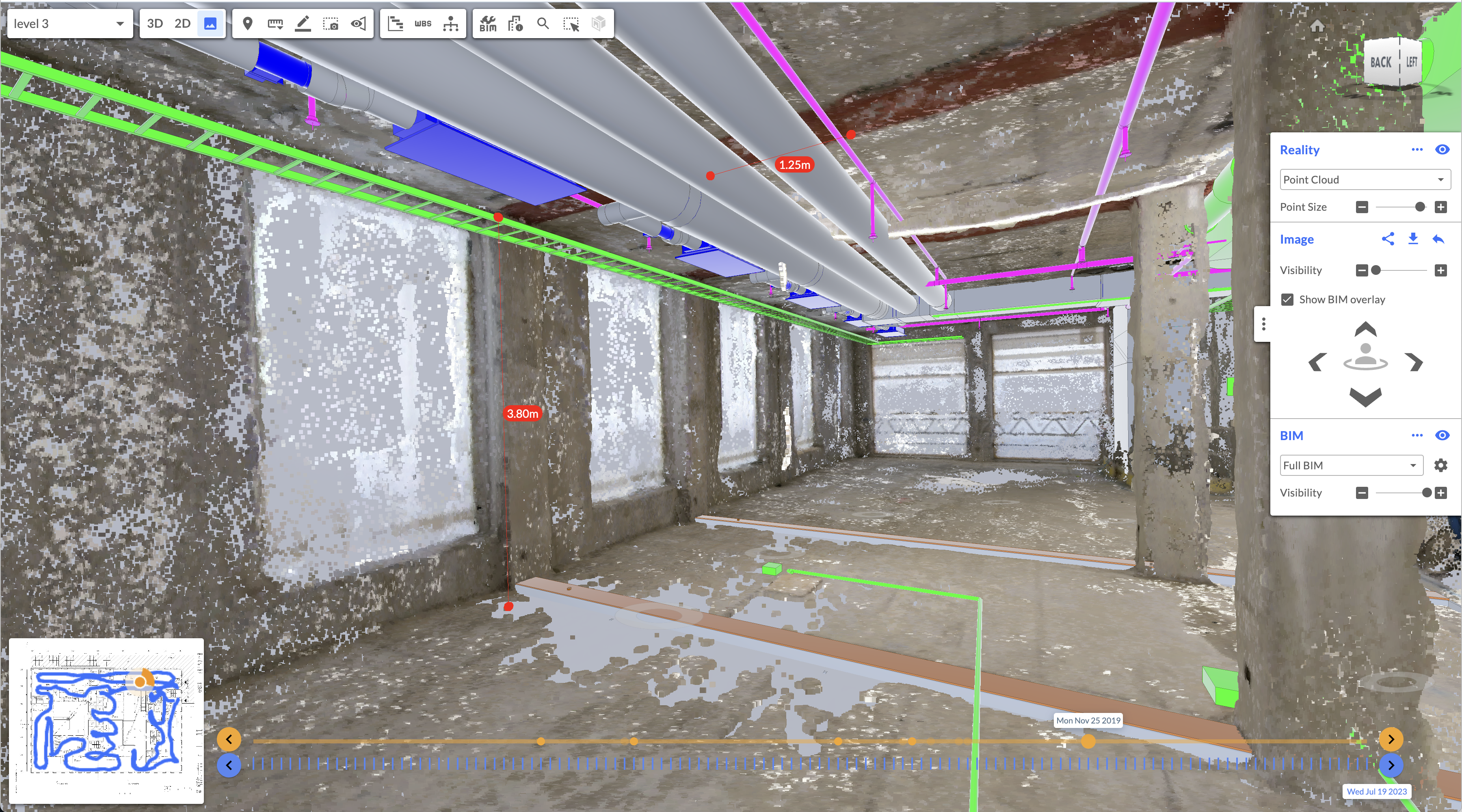
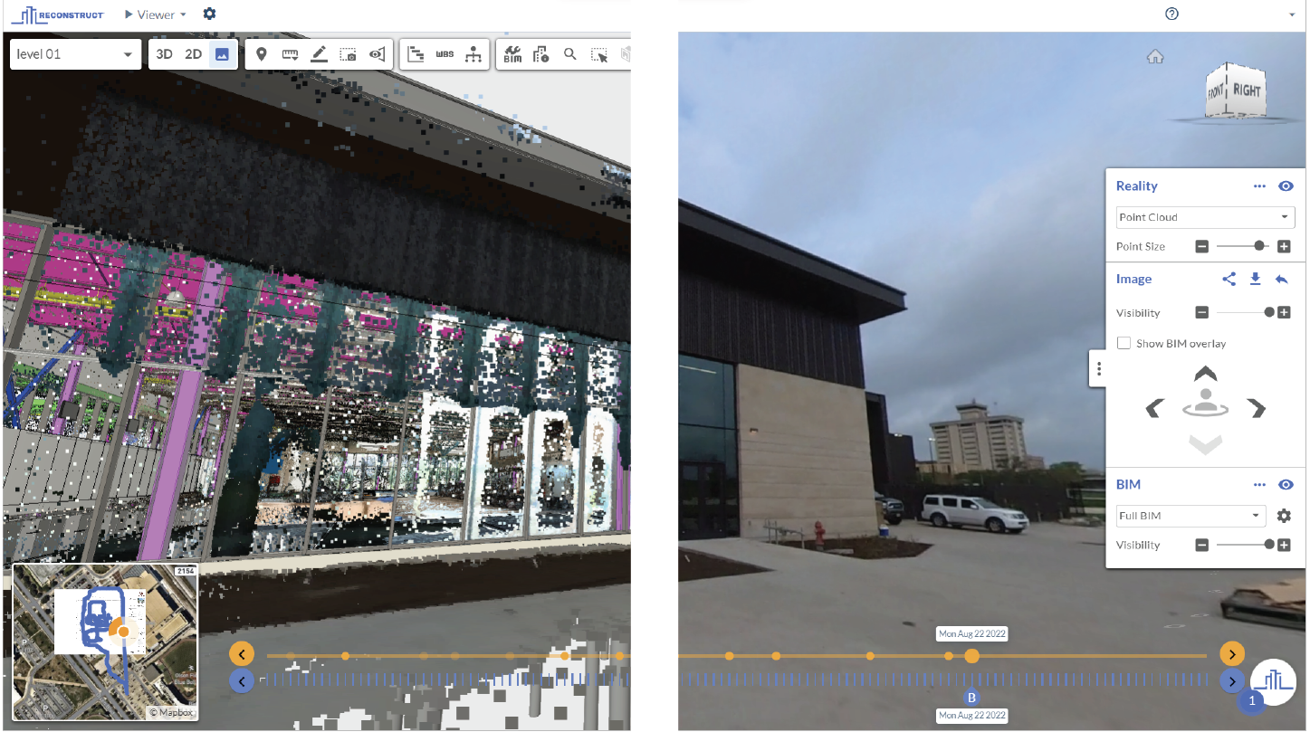
What's more, if a Reconstruct photogrammetry engine is used, footage from 360 capture can be blended with all data (captured from smartphones, drones, laser scanners, etc.) to form a single digital twin. The result is a single source of project truth representing construction at every date and time throughout the project's life cycle.
Once the digital twin is ready, any and all stakeholders who have been granted access can utilize the asset to perform various tasks, including construction progress monitoring, construction quality assurance and quality control, 2D and 3D design integration (during which what was built is compared to what was planned), and more.
When combined with the schedule, the asset can also be used to offer 4D scheduling and 4D visualization, allowing stakeholders to see the next steps of construction brought to life. This can reduce costly mistakes and rework on the job site by ensuring teams perform tasks right the first time.
After construction, the digital twin can serve as a basis for planning future renovations, answering ongoing maintenance questions, and as a time machine for construction that can prevent or shut down legal claims. In fact, many organizations choose to maintain digital archives (also known as online as-builts) of their reality mapping data for a decade or more.
About Reconstruct
Reconstruct has set the gold standard for digital twins in construction. Allowing users to blend any and all reality data to form a single digital twin, there’s no easier way to boost job site visibility for all teams, including remote stakeholders.
To learn more about how easy it is to capture your job site footage and transform it into a digital twin, contact us for a free and personalized demo.

.png)


